
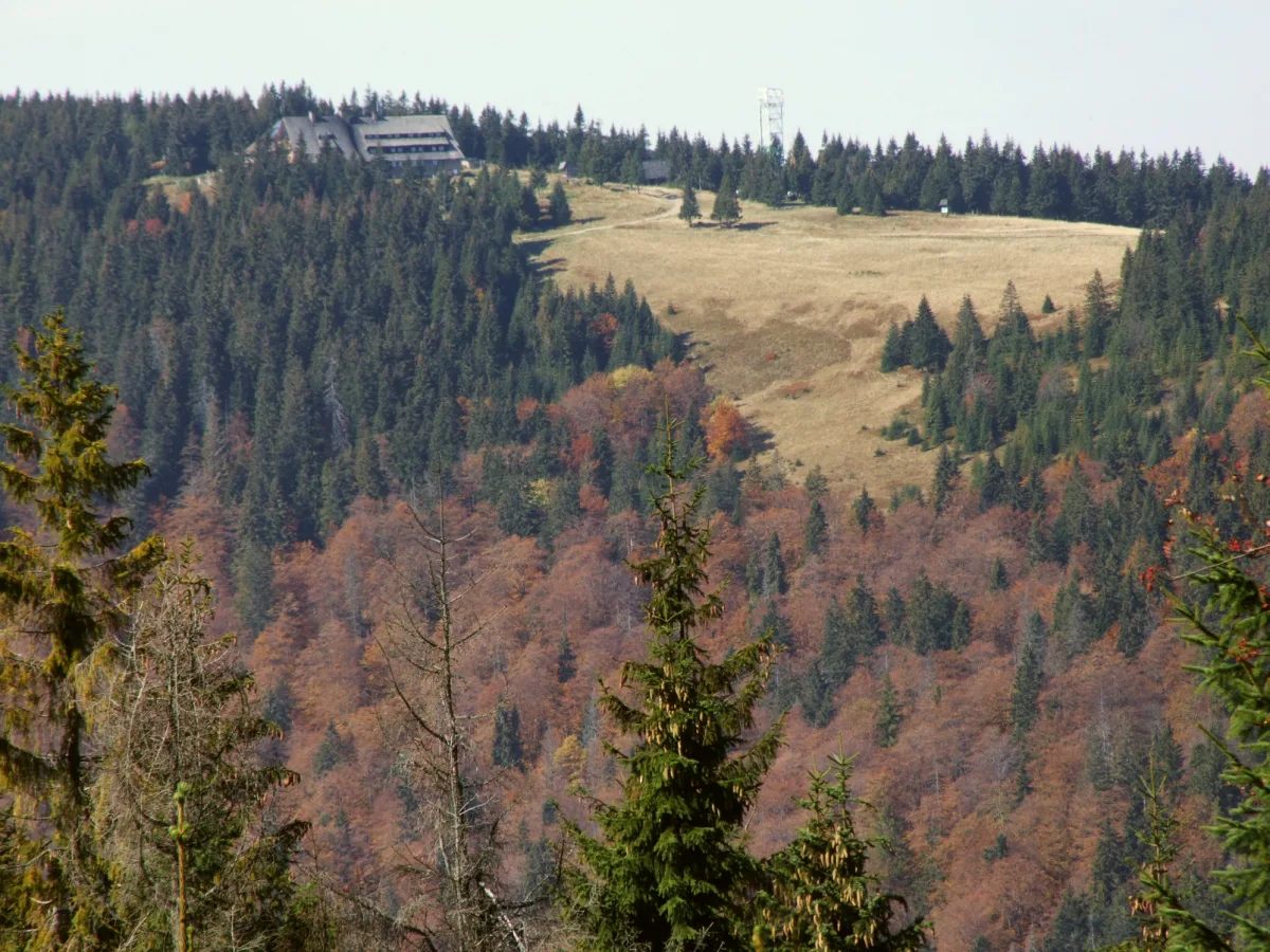
Gorce is a range in the Western Beskids that stretches about 33 km from west to east, with a width of around 15 km. According to Wikipedia it covers about 550 km². The highest peak is Turbacz (1,310 m above sea level), but the character of the range is determined not by the peaks themselves but by what lies between them: forested ridges cut by clearings, from which the Tatras can be seen on clear days.
Clearings: the work of shepherds, not of nature
The Gorce clearings are mostly man-made. According to Gorce National Park and Wikipedia they came into being in the 14th century, when Wallachian settlers with a pastoral culture reached these lands. The forest was burnt and cut down, and the meadow that resulted was maintained by grazing and mowing. Wikipedia even links the name of the range to this: according to the entry on Gorce it probably comes from the word gorzeć (to burn), and the same etymology appears for the peak Gorc, whose name may point to clearings made by the slash-and-burn method. This is a hypothesis, not an established fact.
Wallachian traces also remain in names. For the peak Przysłop (1,187 m) Wikipedia recalls that prisłop in the language of the Wallachians, the founders of Ochotnica, meant a pass.
After the Second World War grazing stopped and the clearings began to be overgrown with bilberry heath, and then with forest. The national park states that it now carries out active protection: sheep grazing has been reintroduced on Hala Długa, and some clearings, such as Jaworzyna Kamienicka, are mown. The reason is ecological: according to the park, about 130 plant species are associated with the clearings, and 13 species of orchids grow on them.
The clearing really worth climbing for the view is Kudłoń. Kudłoń (1,274 m) is the fourth-highest peak of the range and the most prominent within the park's boundaries. The summit itself is wooded and has no views; the panorama comes only from the clearing on the northern slope.
Gorce National Park
The park was established in 1981 on the basis of a resolution of the Council of Ministers of 8 August 1980. It covers 70.30 km², and its buffer zone about 166 km². The directorate is based in Poręba Wielka. Nature protection began here earlier, however: in 1927 the owner of these lands, Ludwik Wodzicki of Poręba Wielka, created the Władysław Orkan Reserve on about 114 ha. The Orkan thread returns below, because the reserve and the writer come from the same village.
According to Wikipedia, forest covers 95 per cent of the park's area: spruce, beech and fir, with an admixture of larch, sycamore and ash. The park lists more than 900 species of vascular plants and 185 species of vertebrates, among them the wolf, the lynx and the brown bear. The symbol of the park is the fire salamander. A detailed description can be found in the entry on Gorce National Park.
One ambiguity is worth remembering. The highest peak within the park's boundaries is Jaworzyna Kamienicka (1,288 m), and according to Wikipedia the summit of Turbacz itself lies outside the park's main boundaries, although the park covers the Turbacz and Gorc massifs. That is why in different descriptions Turbacz is sometimes in the park and sometimes next to it.
Turbacz: the hut, the museum and the chapel
On Turbacz the boundaries of five localities meet: Łopuszna, Waksmund, Obidowa, Poręba Wielka and Szczawa. The PTTK mountain hut stands at an altitude of about 1,283 m. The earlier huts were unlucky: the first, from 1925, burnt down on the night of 16 to 17 November 1933, probably set alight by poachers, and the second was burnt by partisans on 12 November 1943. One source describes it as the first hut in the Western Carpathians destroyed since the start of the war. The building that stands today was opened on 21 August 1958.
Next to it operates an institution that the sources name in different ways: the Museum of Mountain Culture and Tourism on Turbacz or the Gorce Centre for the History of Mountain Tourism. It was founded on 11 May 1980 in a wooden building next to the hut, and today its exhibition is in the hut itself.
On the Rusnakowa clearing, below the summit, stands a chapel with the inscription “Pasterzowi pasterze” (From the shepherds to the Shepherd). Wikipedia calls it the Papal Chapel, the park's website the Shepherds' Chapel. It was built in 1979, and John Paul II received its keys, although he did not consecrate it in person. For Karol Wojtyła the Gorce were the destination of frequent trips: according to the park, on the night of 17 to 18 September 1953 he celebrated Mass in a shepherd's hut on the Turbacz meadow. Since 2003 Mass has been celebrated there at the Hut Altar on the third Sunday of September, and on the second Sunday of August the Mountain Festival takes place at the chapel.
The writer's house on the slope of Pustki
Władysław Orkan was born on 27 November 1875 in Poręba Wielka and died on 14 May 1930 in Kraków. He was first buried in Rakowicki Cemetery, and a year later he was moved to Zakopane, to the Pęksowy Brzyzek cemetery. The pseudonym Orkan (hurricane) was meant to reflect the “rebellious” spirit of Podhale. The writer was a co-founder of the Union of Podhale Highlanders and wrote, among others, “Komorniki” (1900), “W roztokach” (1903) and “Drzewiej” (1912).
With the fee for “W roztokach” he built a house on the slope of Pustki, today the Orkanówka. Here the sources diverge: Wikipedia states that the house was erected in the summer of 1905 and that it was never fully finished for financial reasons, while the museum's entry speaks of work being completed in the spring of 1906. The Orkanówka stands at an altitude of 760 m, in the hamlet of Zagronie, beside the trail leading towards Turbacz. The wooden house is in the Zakopane style, and its ceiling is formed by 36 beams, each with different carving. The exhibitions show the writer's literary path and the culture of the Zagórzanie people. A second institution devoted to Orkan, in the wooden church in Rabka-Zdrój, is described in the text on the spa town.
Mountain huts on the ridges and lookout towers
Gorce does not have many mountain huts, but their placement shapes the routes. The PTTK mountain hut on Stare Wierchy stands in a forest clearing in the western part of the range, at an altitude of 968 m, and is named after Czesław Trybowski. From the clearing you can see the Tatras, the Spiš Beskids and Babia Góra. On the ridge running from Turbacz towards Rabka lies the PTTK mountain hut on Maciejowa, which Wikipedia calls a bacówka (shepherd's hut). The name is misleading, because the building stands on the Przysłop clearing, at an altitude of 852 m, about a kilometre from the summit of Maciejowa. The history of the other PTTK huts in the Beskids is covered separately, in the text on the mountain huts of the Beskids and the Pieniny.
Views are also provided by two wooden towers. On the summit of Gorc (1,228 m) a tower was completed in 2015 as part of the programme “An enclave of active leisure in the heart of Gorce”: it has a covered terrace with labelled panoramas. The tower on Magurki on a side ridge, at the park boundary, stands on a summit 1,108 m above sea level, is 30 m high, and from its platform you can see Gorce, the Sącz Beskids, the Island Beskids and the Tatras (entry on the Magurki tower).
Those who want to see what the highlander culture of Gorce looked like can visit the Studzionki Open-Air Museum in Ochotnica Górna. It is a private ethnographic museum: in the 1950s a Kraków violinist, Zygmunt Stypa, began collecting objects of the Gorce highlanders, and the collection filled the house he built.
Be the first! Add a comment.
You need to log in to add a comment.
Log in