
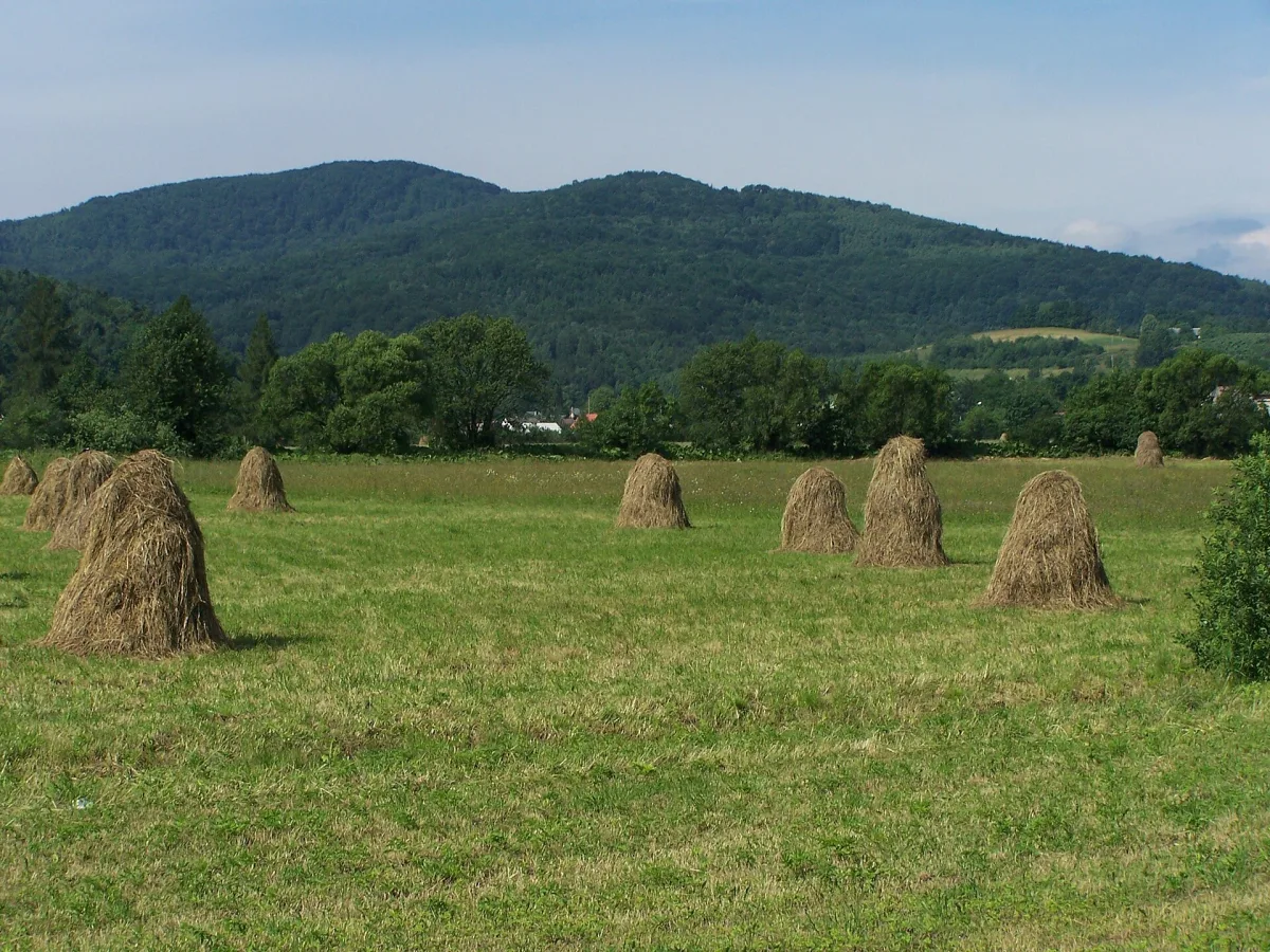
The Island Beskids have no single long ridge that can be walked from one end to the other. Instead there is a series of separate mountains, each surrounded by wide valleys. Hence the name, whose origin is disputed even among the authors of scholarly studies. Below: where the name comes from, why the mountains look like islands, and which peaks form the core of the region. The viewing towers that stand on many of them are covered in a separate article, so they appear here only in passing.
Where it lies and what sets it apart
According to Wikipedia, the Island Beskids are part of the Western Beskids between the Raba valley and the Sącz Basin, with an area of about 1000 km2. They lie entirely in Lesser Poland Voivodeship (Małopolska), and the largest part belongs to Limanowa County. The boundaries are drawn in different ways. The 2018 regionalisation moved the southern boundary so that Magorzyca, Wielki Wierch and Kiczora Kamienicka now belong to the Gorce, although they were formerly counted as part of the Island Beskids.
The highest peak is Mogielica, at 1170 m above sea level. Wikipedia describes the mountains of the region as isolated hills that reach up to 1170 m and rise 400-500 m above gently undulating foothills. The northern slopes are usually steeper than the southern ones, and the summit area is often flat. The exceptions are three ranges: Łososina, Cichoń-Ostra and Cietnia. In the Cietnia range lies the wooded peak of Grodzisko, where the ramparts of an old stronghold survive. According to Wikipedia, it was burnt by Mongol invaders, probably in 1287. In the Łososina Range, Łysa Góra rises above Limanowa, crowned with a concrete cross.
Origin of the name: three versions
The most popular explanation links the name with Kazimierz Sosnowski, a teacher and pioneer of mountain tourism. The story goes that when he spent the night on the summit of Ćwilin with a group of young people, they saw a sea of fog in the morning, with peaks emerging from it like islands. This is a story, not a confirmed fact.
Wikipedia cites two attempts to check the tale. According to research by Dariusz Gacek, the first to use the name Island Beskids was the geographer Ludomir Sawicki, a professor at the Jagiellonian University, among other places in his study “Z fizyografii Karpat polskich” of 1910. According to Adam Kapturkiewicz, the name was coined by neither Sosnowski nor Sawicki: before the war Sosnowski did not write about this area in “Wierchy” at all, and in Sawicki the term “island mountains” described only the shape of the terrain and also applied to mountains in Hungary. The name came into wider use in the mid-1930s in “Wierchy” and other tourist publications, and became common after the Second World War. The dispute over authorship therefore remains open.
The legend has been preserved by Ćwilin itself. The entry for Ćwilin says that it was on Polana Michurowa, a remnant of former pastoral farming, that Sosnowski is supposed to have come up with the term.
Why the mountains look like islands
The explanation is geological. According to Wikipedia, the isolated mountains of the region are denudation remnants of Magura sandstone. Formerly the arrangement of the layers was the reverse: concave forms, that is synclines, were made of hard rock, and convex anticlines of soft rock. When the area was folded and uplifted at the turn of the Paleogene and Neogene, the relief was inverted. Soft shales, marls and thinly bedded sandstones weathered faster and formed gentle slopes and wide depressions, while the resistant sandstones remained as hills. Former valleys became mountains, and former mountains became valleys.
The effect is reinforced by the weather. Wikipedia notes that a sea of fog, caused by temperature inversion, occurs quite often in the region. The isolated peaks then really do rise out of the fog lying in the valleys, like islands in the sea.
Peaks worth knowing
Wikipedia lists the highest peaks of the region: Mogielica 1170 m, Ćwilin 1072 m, Jasień 1063 m, Modyń 1029 m, Luboń Wielki 1022 m, Krzystonów 1012 m, Śnieżnica 1007 m, Szczebel 977 m and Lubogoszcz 968 m. The heights there are rounded to whole metres, hence the small differences from the entries that give Śnieżnica as 1006 m.
Mogielica
Mogielica is 1170.2 m high, and locals call its summit part Kopa. According to Wikipedia, the first mention of the peak dates from the 15th century. The summit areas are covered with stunted spruce forest, the only fragment of the upper montane zone in the whole region. The Mogielica nature reserve lies on the summit and northern slopes. It was established on 12 March 2011 by an order of the Regional Director of Environmental Protection in Kraków dated 30 December 2010 and published on 25 February 2011, which is why two dates appear in different descriptions. The reserve protects the capercaillie and its habitats.
Wikipedia also describes the former Stumorgi mountain pasture on the south-western ridge, where shepherds from Jurków grazed large flocks of sheep. The name comes from an old unit of land area, the morga. Today the clearing is gradually being overgrown by forest.
Ćwilin and Śnieżnica
Ćwilin, the second highest peak of the region, takes its name from the German word Zwilling, meaning twin. According to Wikipedia, it refers to the neighbouring Śnieżnica and was given in the 14th century by German settlers. Wikipedia describes the landslide of 15 August 1927, when a section of the slope broke away after prolonged rainfall, leaving exposed rock above the Rosłaniec stream.
Śnieżnica has three almost equal summits, hence the local name Widłak. It is separated from Ćwilin by the deep Gruszowiec Pass. On the northern slopes of the middle summit, called Wierchy, lies the Śnieżnica nature reserve, established in 1968 to protect natural Carpathian beech forest. It originally covered 8.57 ha, and after enlargement in 2004 it covers 24.92 ha.
Luboń Wielki
Luboń Wielki is 1022 m high and, according to Wikipedia, is the most prominent peak of the region. Locals used to call it Biernatka. On the summit stands a PTTK (Polish Tourist and Sightseeing Society) mountain hut from 1931, entered in the heritage register in 2009, as well as a radio and television mast from 1961, built to enable the broadcast of the FIS World Championships in Zakopane. On the south-eastern slope the reserve protects the largest boulder field in the Island Beskids, rocks known as Dziurawe Turnie, and a cave. The most difficult trail here follows Perć Borkowskiego, where within the reserve one has to climb over rocks.
Lubogoszcz
Lubogoszcz has three summits: the western Zapadliska (766 m), the middle Lubogoszcz Zachodni (953 m) and the highest, eastern one, at 968 m. Above about 500-550 m it is completely forested, so views are offered only by the lower parts of the trails and by windthrow areas. Wikipedia counts the landslides in the area of Zapadliska and Żabie Oczko among the largest in the region. Żabie Oko is a pond filling a landslide niche. The name was given by tourists, and the local people used to call it Stawisko. The northern slopes are protected by the Lubogoszcz nature reserve.
Modyń
Modyń is 1029 m high and has two summits, 1028.5 and 1026.5 m. It is almost entirely covered with forest, and on the southern slopes lies a cave, one of the larger ones in the region according to Wikipedia. The viewing tower on the summit is described in the article on towers.
Traces of war on the lower mountains
Not all of the important mountains of the region are high. Kobyła, also called Kobyla Góra, is about 600 m high, but Wikipedia gives three heights depending on the source: 605 m according to Geoportal, 603 m according to the Compass map and 613 m according to Krygowski's guidebook. During the First World War, in the so-called Battle of Limanowa, the strategically important mountain changed hands six times between the Russian and Austro-Hungarian armies. On the northern slope the war cemetery no. 300 Rajbrot-Kobyła has survived, and the events are commemorated by a monument in the Mulowiec clearing. Wikipedia also writes about numerous cemeteries from these battles elsewhere in the region, for example in Męcina and Kasina Wielka.
Be the first! Add a comment.
You need to log in to add a comment.
Log in