
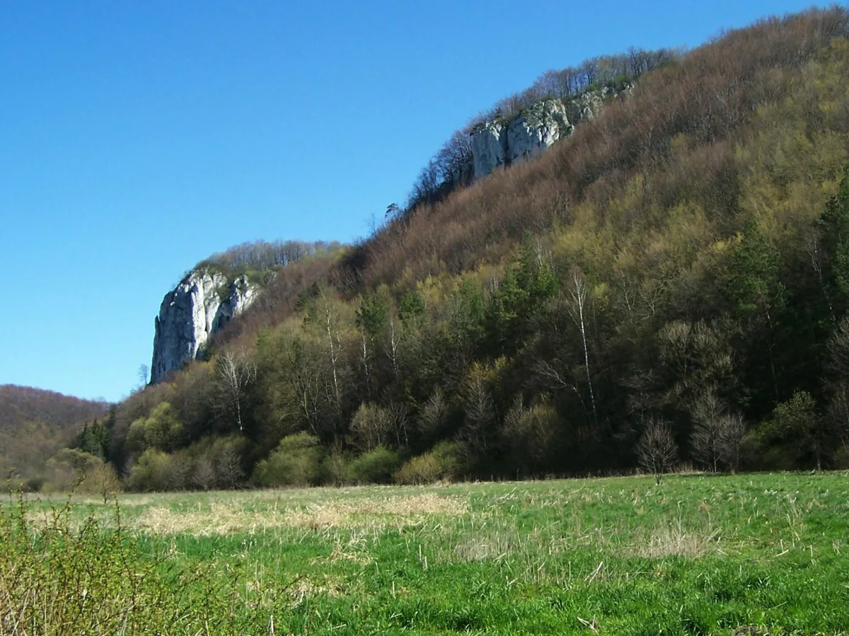
The limestone rocks of the Kraków-Częstochowa Upland (Polish Jura) stand singly, in groups, or as walls above the valley floor. Some have names from legends, others from the names of poets, and still others from a shape that the imagination matches to a hand, a club or a needle. This article puts several of them in order: it explains where they came from, who named them, and on which of them climbing is allowed and on which it is forbidden.
Why so many rocks on the Jura
According to Wikipedia, Upper Jurassic limestones dominate here, forming an extensive plateau. The limestone outliers rising above it, up to several dozen metres high, arose through karst processes that lasted in the subtropical climate of the Tertiary. An outlier, in turn, as the same encyclopedia defines it, is an elevation left after the weathering, erosion and denudation of its surroundings: water and time carried away the rock around it, and a fragment of the massif remained in place.
The rock itself has an even older biography. A geotourism board prepared by specialists from the AGH University of Krakow, described in the entry on Sokolica in the Będkowska Valley, speaks of microbial-sponge structures that grew out of reef-like formations in the shallow shelf sea of the Upper Jurassic. Cyanobacteria and sponges played the key role in them, and their skeletons can be found in the structure of the rock. The rocks we walk among today are therefore former sea floors.
This article covers rocks from various parts of the Jura, but the great majority lie in the Prądnik Valley. The national park itself and its caves are dealt with in separate articles; here the rocks remain.
Deotyma's Needle: a rock named after a poet
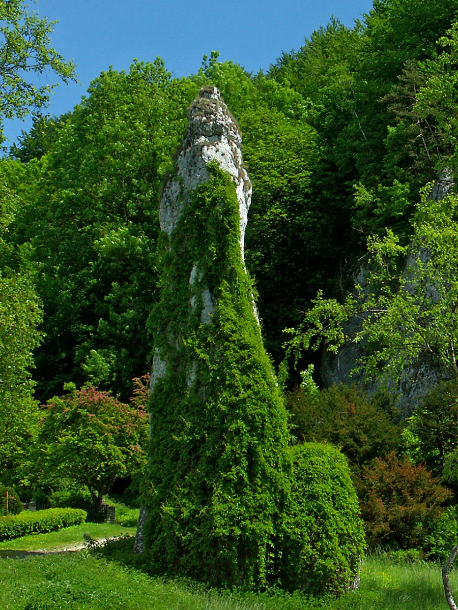
Deotyma's Needle (Igła Deotymy) is a slender outlier of Jurassic limestone that rises at the mouth of the Wrześnik gorge, on the eastern side of the Prądnik, between the Panieńskie Rocks and the Kawalerskie Rocks. The name comes from the word Deotyma, which was the literary pseudonym of the poet Jadwiga Łuszczewska. Wikipedia states that the rock was named thus in memory of the poet's visit to Ojców in 1853. The entry on the poet says the same: she visited the Prądnik Valley in 1853, and the name of the outlier commemorates her. She reportedly lived in the Pod Koroną villa, right next to the rock, and in the valley was said to draw inspiration for her poems. This is a guidebook account, written down with the word "reportedly", so we treat it that way.
Around the Needle grow planted Ojców birches, a very rare species, and the rock itself is entwined with Virginia creeper, which turns red in autumn. The rock is not open to rock climbing. It is viewed from the green trail, which leads from Ojców through the Prądnik Valley past the Needle, then through Wawrzonowy Dół, past the Rękawica rock and onto Góra Koronna.
Rękawica: the legend of a hand covering a cave
Rękawica (the Glove), also called Pięciopalcówka (Five-Finger Rock) or Biała Ręka (White Hand), rises about 85 metres above the floor of the Prądnik Valley, on the western slope of the Góra Koronna massif. Its upper part consists of five finger-like columns that form the outline of a hand. The name came from this shape, and the legend from the name.
The legend says that during one of the Tatar raids the local people hid in the nearby Dark Cave (Jaskinia Ciemna) while the Tatars searched the valley. God was then said to have covered the entrance to the cave with his own hand and saved the people from death or slavery, and the rock is supposed to be the trace of that hand. This is a legend, not a historical fact. From close up, in profile, the rock can be seen from the platform at the cave entrance, and from afar from the valley floor and from the trail across Góra Koronna. Climbing on Rękawica is forbidden.
Jonaszówka: a rock with a viewing platform
Jonaszówka, also called Gruby Janek (Fat John), is about 20 metres high and stands on the right slope of the valley, at the mouth of the side Sąspowska Valley. Together with the Plażówki rock on the other side of that valley it forms a rock gateway, although a poorly recognisable one, because the mouth of the valley is wide. At its foot lie ponds with rainbow trout farming. Wikipedia adds an interesting detail: the floor of the Sąspowska Valley and of the Prądnik once lay at the top of Jonaszówka, which shows well how much rock has disappeared from the surroundings.
The rock is known above all as a viewpoint. A path with a handrail leads to the top from the valley floor, and at the top there is a flat platform with barriers and a panorama board. From here both valleys and the castle in Ojców can be seen, and on the opposite slope the rocks of Czyżówka, Figowe Skały, Ostroga and Bystra stand out white.
Hercules' Club: a rock with four names
Hercules' Club (Maczuga Herkulesa) stands in Pieskowa Skała, a few hundred metres from the castle, and is about 25 metres high. Wikipedia counts it among the best-known rocks in Poland and derives its name from its shape. The rock stands on a terrace 8-12 metres high, and on the western side rises the Fortepian (Piano), on which stands the castle in Pieskowa Skała. According to the same entry, the Club was formed through the karst action of water and the uneven resistance of the limestone to weathering.
In the past it was called by other names, and a legend was attached to each. Wikipedia, citing a collection of Prądnik-area legends from 1928, lists four:
- Krak's Club: according to the legend, Prince Krak killed a dragon with an enormous club and left it at the mouth of the valley as a warning.
- Falcon Rock: a tale of a peasant imprisoned in the tower of the Ojców castle, to whom falcons were said to have brought a chick from the top of the rock.
- Devil's Rock: the devil was said to have carried the rock to the valley while carrying out one of the tasks set by the sorcerer Twardowski, and to have set it thinner end down.
- Twardowski's Rock: a version from a record by Stanisław Ciszewski of 1887, according to which devils turned it over with the broad side up.
The first confirmed ascent of the summit belongs to Ludwik Ziemblic and Franciszek Żurek in 1913. Wikipedia notes that the dates 1933 and 1935, often repeated in guidebooks and attributed to other climbers, are wrong. Since the creation of Ojców National Park, climbing on the Club has been forbidden.
Pochylec and rocks where climbing is allowed
The rocks of the Jura are also one of the main climbing areas in Poland, but the rules differ from place to place. Pochylec is a limestone crag up to 26 metres high, distinctly tilted, on the left slope of the Prądnik Valley at the junction of road no. 773 with the road to Ojców. Wikipedia calls it a cult rock and one of the most famous climbing rocks in Poland. Climbers reached an agreement with the park's management, which opened the rock on set conditions, and under the "Nasze Skały" (Our Rocks) initiative a starting platform was built beneath the wall. Most routes are hard or very hard, so this is not a place for beginners. For a walker it is simply a rock to look at from the road, ideally with respect for the people working on ropes.
In the Będkowska Valley, as Wikipedia states, more than 80 rocks have been opened to climbing, and Sokolica has a wall up to 60 metres high, regarded as the tallest on the Jura. A smaller site is the Dziurawy Okap in the Witkowe Rocks above the Szklarka Valley, a rock shelter with two openings and a fissure-like passage. The general rule is this: on the Jura climbing is permitted only on rocks designated by the land manager, and on many important rocks, such as the Club, Rękawica and the Needle, it is forbidden. Climbing requires equipment, experience and knowledge of the rules of the particular area. Anyone without a course should view the rocks from the ground.
Kmita's Rock and rocks outside the Prądnik Valley
Kmita's Rock (Skała Kmity) is a landscape reserve in Zabierzów, at the place where the Rudawa breaks through the Tenczyn Ridge. The reserve, with an area of 19.36 ha, was created in 1959. The main rock is an almost vertical limestone wall about 25 metres high, with historic inscriptions carved in 1854, among them stanzas by Wincenty Pol. A legend from the early 16th century says that the knight Kmita, unhappily in love with Olimpia Bonerówna, threw himself from this rock together with his horse. Wikipedia states outright that no documents have survived confirming Kmita's death by suicide. The rock rises above provincial road no. 774, and from the former restaurant by the car park one can climb to the top. A 2.5 km educational trail leads from the reserve into the Grzybowska Valley.
On the Tenczyn Ridge also lies Bukowa Góra, a wooded hill 378 m above sea level in the village of Nielepice. It is more an example of a hill than of a crag: in the description there is no trail to the summit itself, and the surroundings are partly industrial, because a limestone quarry operates here.
Of an entirely different character is the Góra Stołowa im. Ryszarda Malika nature reserve in Klucze municipality on the Olkusz Upland. It was created on 25 May 2021, covers 96.09 ha and protects a forest ecosystem with beech woods, and the terrain is varied by rock outliers that interweave with the forest. Access is from Jaroszowiec, and the reserve is subject to the prohibitions that apply to this form of protection.
Where to see it all
Most of the rocks of the Prądnik Valley can be seen in a single outing along the green trail from Ojców: Deotyma's Needle, Wawrzonowy Dół, Rękawica and the viewpoints on Góra Koronna. Not far away, in the same valley, lies Łokietek's Cave, described separately. The rules for entering the park and the current restrictions on trails should be checked with the park's management before setting out, as they may change.
Be the first! Add a comment.
You need to log in to add a comment.
Log in