
Babia Góra is a massif, not a single peak, and lies on the border between Poland and Slovakia. Its northern slopes belong to Zawoja, a village that is described as the largest and longest in the country. This text sets out what the sources say about the mountain, the national park and Zawoja, including where they contradict one another.
How high is Diablak: 1,725 or 1,724 metres
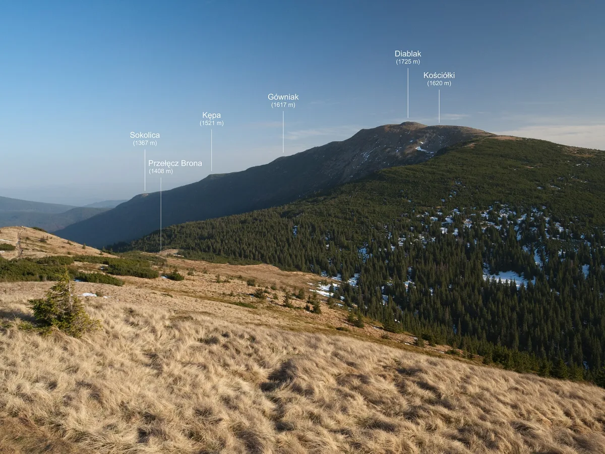
The highest summit of the massif is called Diablak, while the name Babia Góra usually refers to the whole. The website of Babia Góra National Park, and also the mountain hut at Markowe Szczawiny, give a height of 1,725 m above sea level. Wikipedia notes that maps show 1,725 m or 1,722.9 m, and that more recent measurements gave values slightly below 1,724 m: Polish laser scanning of 2014 gave 1,723.8 m, Polish geodetic measurements of 2019 gave 1,723.6 m, and Slovak scanning of 2019 gave 1,723.7 m. The entry for Babia Góra adopts 1,724 m. The difference does not matter to a walker, but it is good to know where it comes from.
According to Wikipedia, it is the highest peak of the Western Beskids and, apart from the Tatra Mountains, the highest peak in Poland. It is counted among the Crown of Polish Mountains. The park also states that the whole range is about 10 km long, with steep and precipitous northern slopes and much gentler southern ones.
Origin of the name: legends and the first record
The origin of the name is explained by several legends, which Wikipedia collects together. According to one, the mountain is a heap of stones that a giant old woman (baba) tipped out in front of her cottage. According to another, it is a brigand's lover who turned to stone with grief when she saw her slain beloved being carried. Yet another legend tells of brigands who hid the women they had captured in caves under the mountain. These are legends, not findings by historians. The same Wikipedia adds that the name may be connected with the meanings of the word baba (a kind of cake, or a stone cult statue), and that in the common explanation it refers to the squat shape of the mountain, similar to a seated woman.
The first mention of the mountain is attributed to Jan Długosz. Wikipedia dates it to 1468 and quotes the description: a very high mountain, above the River Soła, rich in various herbs, near the little town of Żywiec. The park's website is more cautious and writes only of the second half of the 15th century. Among earlier names Wikipedia also lists the Queen of the Beskids, the Mother of Bad Weather and the Capricious One, because the weather on the summit changes abruptly.
The national park and the biosphere reserve
Efforts at protection began in the Second Polish Republic. According to the park's website, in 1928 403 ha of the summit areas were placed under reserve management, and in 1933 a reserve of about 642 ha was created. The park was established by a regulation of the Council of Ministers of 30 October 1954. In one place the park's website states that it initially covered 1,642.18 ha, and in another that it covered 1,703.70 ha, so we do not give the original area as certain. In 1997 the area was enlarged to 3,391.55 ha. The park's website now gives 3,393.34 ha, and the park lies in three municipalities: Zawoja, Lipnica Wielka and Jabłonka.
Babia Góra also has the status of a UNESCO biosphere reserve, and here the sources diverge. The park's website writes that it obtained the status in June 1976, as one of the first areas in the world. Wikipedia gives the date 17 January 1977, and the entry for Babia Góra adopts the year 1977. The reason for the distinction is the well-preserved sequence of vegetation zones.
This sequence can be seen on the northern slopes. According to Wikipedia, in the lowest zone, the lower montane forest, remnants of an almost primeval Carpathian forest have survived. Higher up grow the natural spruce forests of the upper montane zone, then dwarf mountain pine, and on the very summit there is an alpine meadow zone, the only natural one in the Beskids. Wikipedia calls Babia Góra the only massif in the Polish Beskids with high-mountain features. The park's nature is presented by the Educational Centre of Babia Góra National Park in Zawoja Markowa, a museum with four permanent exhibitions. One of them is a stylised highlander cottage.
Little ponds and a fir that is no more
On the slopes of the massif lie small ponds. They were formerly regarded as glacial, but today researchers describe them as landslide ponds, formed by movements of rock masses on the Carpathian flysch. Marków Stawek lies at a height of 1,135 m, below the Borsucze Skały rocks. According to Wikipedia, it is the highest breeding site of the Carpathian newt on Babia Góra.
Lower down, in the Kniei Czatożańska forest, stood the Gruba Jodła (Thick Fir). According to Hugo Zapałowicz's measurements, the circumference of the trunk at breast height was 6.76 m, and its age at death is estimated at more than 600 years. Wikipedia calls it the oldest fir in Poland, but this is an assessment from the entry on the tree itself, not the result of a comparison with other specimens. At the end of the 19th century the fir was struck by lightning, then shepherds lit a fire in the rotting trunk, and in 1914 the wind brought it down. In 1960, at the request of Professor Władysław Szafer, the base of the trunk was recreated in concrete.
Trails and mountain huts from the north
The most common starting point is the Markowe Szczawiny clearing at a height of 1,180 m. There stands the PTTK mountain hut. According to Wikipedia, the first building, opened on 15 September 1906 on the initiative of Hugo Zapałowicz, was the first Polish mountain hut in this part of the Beskids. It was meant as a response to the expansion of the German Beskidenverein society. The old building was demolished in 2007, and the new one opened on 21 November 2009. The entry on the clearing itself gives the year 2010, so for this date it is better to check the hut's current information.
The Germans of the Beskidenverein built their own hut just below the summit. It operated in 1905-1949 and burned down after the war in unexplained circumstances, and today only its foundations remain, described as the ruins of the Beskidenverein hut. The same society marked out in 1894 the first waymarked trail up the mountain, from the side of Orawska Półgóra.
Wikipedia describes three Polish routes to the summit. The red Main Beskid Trail runs from Markowe Szczawiny through the Brona pass. The yellow one follows the Akademicka Perć (Academics' Path), a trail marked in 1925 by Władysław Midowicz, with chains at a harder spot. The green one starts from the Jałowiecka Pass via Cyl. From the east the red trail from Krowiarki Pass leads first through Sokolica, a rock viewing platform on the ridge, and then through Kępa. Not to be confused with Sokolica in the Pieniny. The height of Sokolica is given differently by different sources: 1,367 m in Wikipedia and on the park's website, 1,368 m in the entry.
Zawoja: the largest, but the longest?
Zawoja lies at the foot of Babia Góra, in the valley of the Skawica. Wikipedia states that it is the longest village in Poland, about 18 km long, and the largest by area, covering 100.78 km2. The municipality's official website says less: it calls Zawoja the largest village in Poland by area and population and does not mention length. The length record therefore appears only in Wikipedia, and we have not found a ranking that confirms it.
A rival in talk of records is sometimes Sułoszowa in Kraków County. Its entry on Wikipedia calls it one of the longest linear villages in Poland, that is, villages stretching along a single road, and gives a length of about 9 km, and for the period of the Second Polish Republic 14 km. On the figures from the same sources Zawoja comes out longer, but the authors of the entries give no common method of measurement, so this comparison does not have the status of a ranking. It is safer to say that both villages are among the longest in the country, and that Zawoja's record is stated by Wikipedia.
The name of the village comes, according to Wikipedia, from the Wallachian word zavoi, which means a bend of a river or a forest by a river. Zawoja has existed as a separate village since 31 August 1836, and the first mention of it as a newly founded village free of serfdom dates from 1646. The lower part, Skawica, is recorded as early as before 1593.
What to see in the village itself
In the centre stands the wooden Church of St Clement of 1888, built on a cruciform plan on the site of an older, small church. The polychromy was made in 1930 by two Kraków artists, Zygmunt Milli and Marian Arczyński.
In Zawoja Markowa there is the Józef Żak open-air museum, which began in 1973 with the purchase of a plot with the Kudzia family cottage from around 1900. The oldest cottage, the Słopniak house, dates from 1802-1815 and was brought here in 1987 from the hamlet of Budzonie. The whole shows the wooden building of the Babiogórcy, that is, the highlanders of Babia Góra.
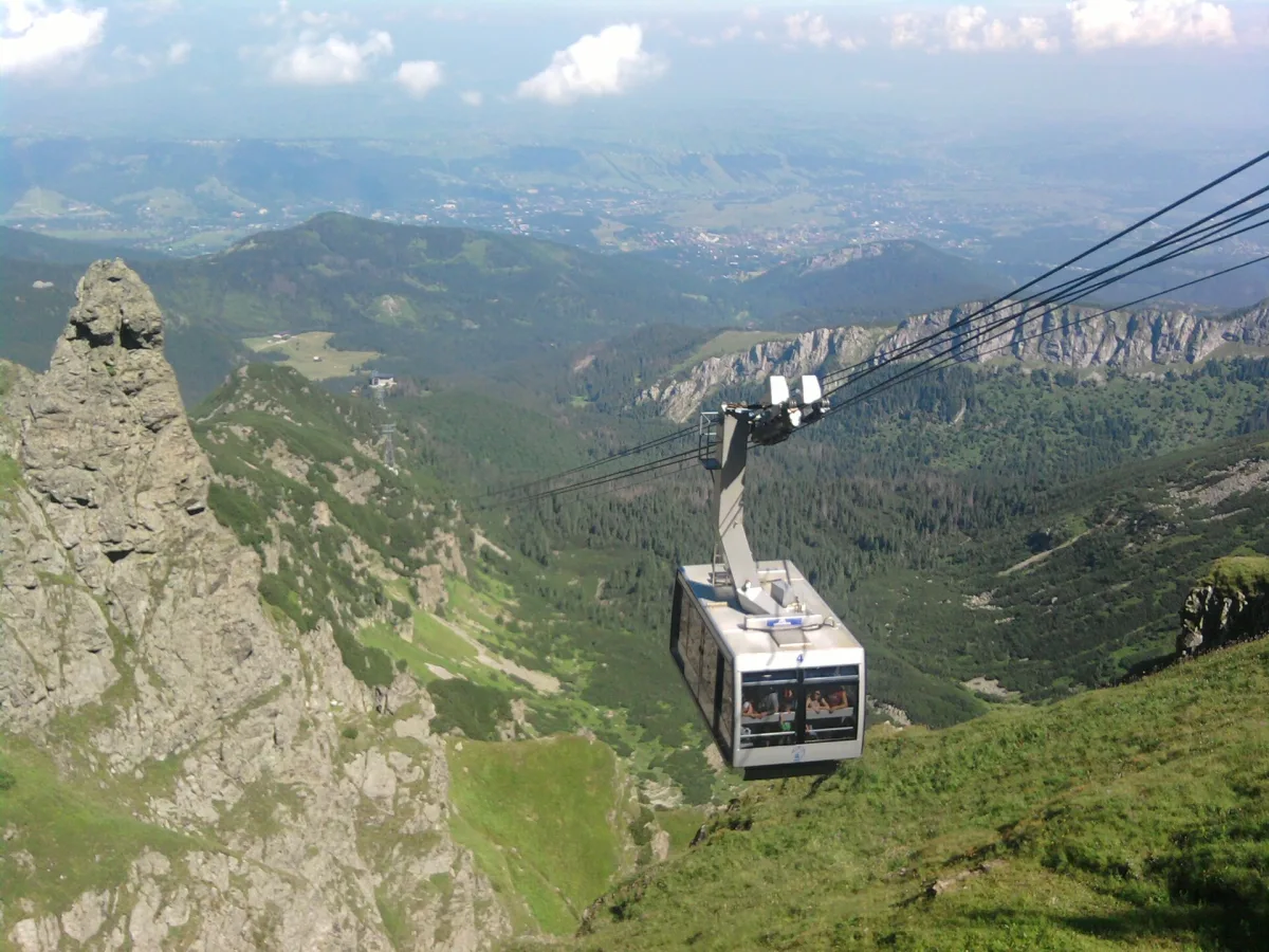
In Zawoja there also rises Mosorny Groń. It is reached by chairlift, and at the upper station stands a steel viewing tower, described in a separate text on the towers of the Island Beskids and surroundings and in the entry on the tower on Mosorny Groń. Wikipedia notes that the resort's ski run has an FIS licence for national and international competitions.
The Polica range, on the other side of Krowiarki Pass, is protected by the Prof. Zenon Klemensiewicz Reserve on Polica. It was created in 1972 for a natural spruce forest. On the northern slope of Polica on 2 April 1969 a LOT scheduled airliner crashed, and 53 people died in the disaster, everyone on board. Among them was the linguist Zenon Klemensiewicz, after whom the reserve takes its name. Wikipedia reports a monument to the victims on the summit of Polica. The neighbouring, younger reserve of 1998 is the Na Policy nature reserve, located in the municipality of Bystra-Sidzina.
Be the first! Add a comment.
You need to log in to add a comment.
Log in