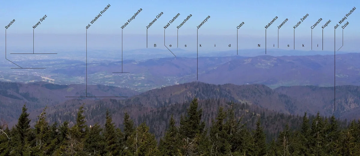
A forested peak of 888 m in the Grybów Mountains, the highest in the Kozie Żebro and Czerszla range.
Kozie Żebro (888 m above sea level), also called Kocie Żebro, is a forested peak in the western part of the Low Beskids, in the Grybów Mountains. It is the highest elevation of the Kozie Żebro and Czerszla range.
The summit lies between Jaworzyna (821.6 m) in the west and Tokarnia (830.2 m) and Czerszla (877 m) in the east. The southern slopes descend steeply to the valley of the Tokarski Stream, the northern ones by a long arm to Bogusza. They are covered with spruce-beech and spruce-fir forests, and at the summit there are gaps with views.
A yellow trail runs along the ridge: Nowy Sącz (Jamnica), Kozie Żebro, Czerszla, Florynka, Wawrzka, Ropa, Gorlice. It is not far from here to neighbouring peaks, such as Czerszla. From Łabowa unmarked paths lead up.
In Gorlice County lies another Kozie Żebro (847 m), with which a nature reserve is associated. It is a separate ridge, on the other side of the Low Beskids.

Be the first! Add a comment.
You need to log in to add a comment.
Log in