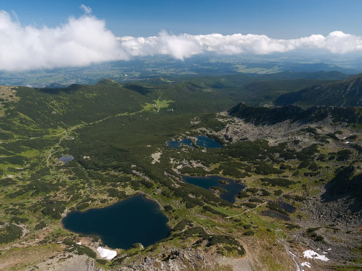
South-western part of the Gąsienicowa Valley with 19 ponds, Roztoka Stawiańska and glacial cirques below the main ridge of the Tatras.
The Zielona Gąsienicowa Valley is the south-western part of the Gąsienicowa Valley in the Tatra Mountains (Tatras). It lies in the continuation of the Sucha Woda Valley, where it forms a large, almost flat area called Roztoka Stawiańska, and stretches as far as the main ridge of the Tatras.
The valley reaches the peaks of the main ridge and the eastern ridge of Świnica, from Kasprowy Wierch to Zawratowa Turnia. In the east it is separated from the Czarna Gąsienicowa Valley by the ridge of Mały Kościelec and Kościelec, and to the north-west it is bounded by the slopes of Uhrocie Kasprowe. In the upper part there are glacial cirques: Świnicka Kotlinka and Mylna Kotlinka, and below it a boulder field called Zadnie Koło. Below Kasprowy Wierch lies the Sucha Stawiańska Valley, also called Kocioł Kasprowy or Gąsienicowy.
The Zielona Valley holds 19 of the 21 ponds of the whole Gąsienicowa Valley, according to the guidebook by Witold Henryk Paryski. In reality the number varies from 19 to 22, because some of the small ponds dry up in a dry summer. The largest are Zielony Staw Gąsienicowy (3.764 ha), Długi Staw Gąsienicowy (1.564 ha) and Kurtkowiec (1.536 ha, with an island). Right by the yellow trail, about 300 m from the mountain hut, there is also Mokra Jama.
Four marked trails cross the valley. The yellow one leads from the mountain hut to Kasprowy Wierch, the black one from Roztoka Stawiańska to Świnicka Pass, the green one towards Liliowe, and the blue one links the black trail with Karb. The starting point is the “Murowaniec” PTTK mountain hut, and next to it lies Czarny Staw Gąsienicowy. The neighbouring part of the valley is the Gąsienicowa Valley.

Be the first! Add a comment.
You need to log in to add a comment.
Log in