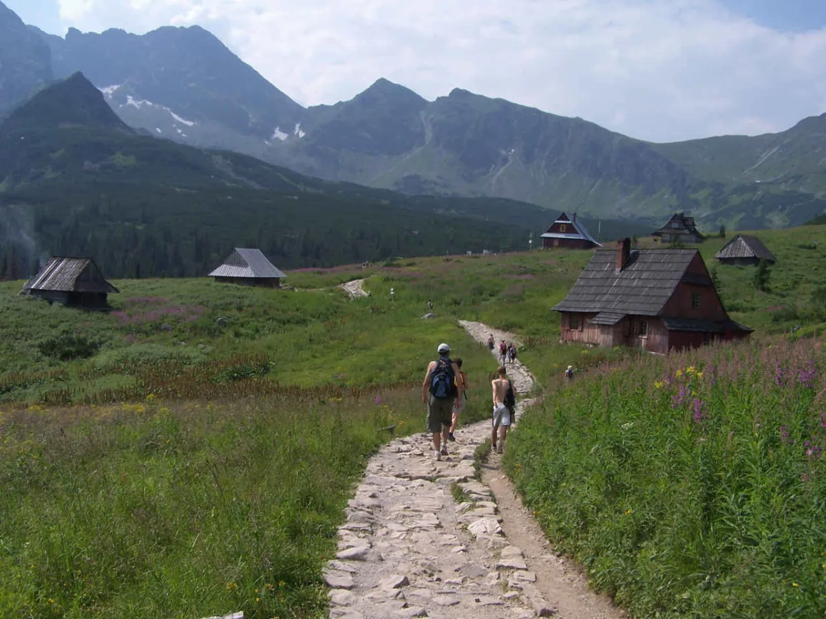
Upper tier of the Sucha Woda Gąsienicowa Valley in the Polish Tatras, with Czarny Staw Gąsienicowy, the Murowaniec hut and two branches.
The Gąsienicowa Valley is the upper tier of the Sucha Woda Gąsienicowa Valley in the Polish Tatras. It separates from the lower part at an altitude of 1,425 m, where the Czarny Potok stream flows into the Sucha Woda Gąsienicowa. It used to be called the Valley of the Gąsienicowe Ponds, and on 19th-century maps the name Valley of the Seven Ponds appears.
The valley has two branches separated by the Grań Kościelców ridge: the eastern Czarna Gąsienicowa Valley and the western Zielona Gąsienicowa Valley. Both contain lakes known as the Gąsienicowe Ponds, and their list exceeds sixteen bodies of water.
The largest is Czarny Staw Gąsienicowy, with an area of about 17.9 ha, lying in the black branch. In the Zielona Gąsienicowa Valley lie, among others, Zielony Staw (3.76 ha), Długi Staw (1.56 ha) and Kurtkowiec (1.54 ha), and next to them smaller pools. Czarny Staw has its own entry: Czarny Staw Gąsienicowy. According to the portal's data it lies about 1.6 km from the centre of the valley.
The name comes from the Gąsienica family, the former owners of this land. The valley was part of Hala Gąsienicowa, where sheep had long been grazed intensively. Grazing here is documented in 1653. Today natural succession is under way on the former pastures: the land is being overgrown with forest and dwarf pine. Water from the valley also flows underground, to the Goryczkowa Valley (the Goryczkowe resurgence) and to the Kasprowa Valley (Kasprowa Niżnia Cave).
The trail junction is the Murowaniec hut, built in 1921-1925 and described in the entry for the PTTK Mountain Hut Murowaniec. The valley also holds the Betlejemka mountaineering training centre, the Tatra National Park ranger station Księżówka, a meteorological station of the Polish Academy of Sciences, the Gawra building and shepherds' huts.
According to Wikipedia, the walk from Kuźnice to Murowaniec takes about two hours. According to Wikipedia, trails lead from the valley to Kasprowy Wierch (about 1 hour 5 minutes), Zawrat, Wierchporoniec and the Krzyżne Pass. There are also peaks in the area, among them Kozi Wierch and Wielki Kopieniec. The neighbouring valley with lakes is described in the entry for the Valley of the Five Polish Ponds. Ski lifts operate in the valley, and the area is also a base for climbing and skiing.

Be the first! Add a comment.
You need to log in to add a comment.
Log in