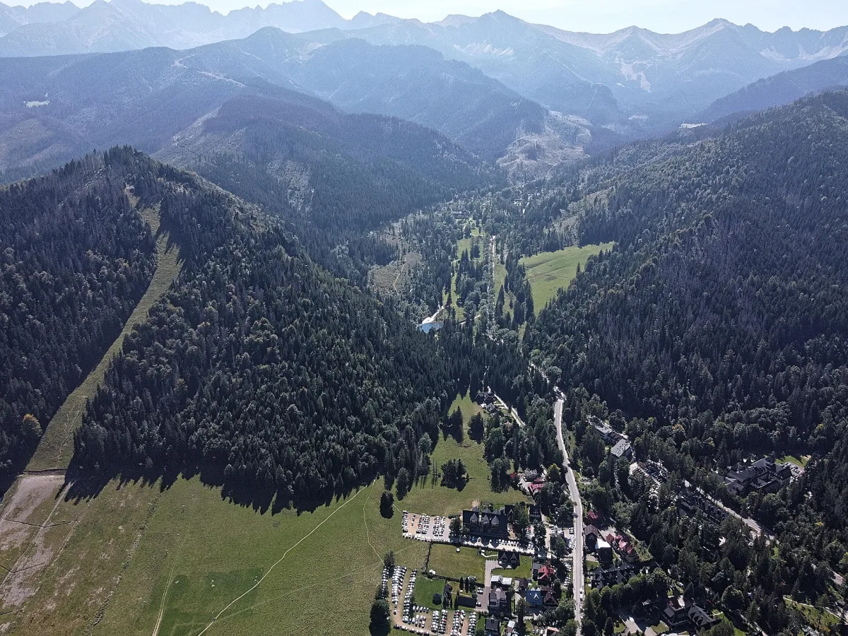
A large valley in the Western Tatras with its mouth in Zakopane, with Kuźnice at the entrance and trails to Giewont and Kasprowy Wierch.
Dolina Bystrej is a large valley in the Polish Western Tatras, whose mouth lies in the Zakopane Basin, between the slopes of Nosal and Krokiew. It is about 6 km long and has an area of roughly 17 km². The whole valley belongs to Tatra National Park, and a large part of it is under strict protection.
The entrance to the valley is Kuźnice, situated at 930 m above sea level. Minibuses, taxis and residents' cars go there, so getting there from Zakopane is simple. In Kuźnice stand the lower station of the cable car to Kasprowy Wierch and a TOPR (Tatra Volunteer Rescue Service) point, and Nosal rises above the valley.
Along the bottom of the valley flows the Bystra, formed by the Goryczkowy and Kasprowy streams. On its course lie three karst springs: Wywierzysko Bystrej, Goryczkowe Wywierzysko and Kasprowe Wywierzysko. Among the caves of the valley the sources name the Magurska Cave, the Bystra Cave and the Kasprowa Niżnia Cave; their entrances should not be treated as accessible without permission and preparation.
Several trails lead from the Kuźnice area. The blue trail runs to Giewont through the Kondratowa Valley, while the green leads to Kasprowy Wierch and also branches off from the hut in Kondratowa. The yellow trail leads through the Jaworzynka Valley and the monastery trail, and the black one is the Ścieżka nad Reglami. In the valley there is also the Jaworzynka hotel, two convents (of the Albertines and the Albertine Sisters) and the PTTK (Polish Tourist and Sightseeing Society) mountain hut at Kalatówki. Higher up you will find the PTTK mountain hut on Hala Kondratowa, and from here it is easy to combine a walk with an ascent of Giewont.
For several hundred years the valley was exploited: sheep were grazed in it, ore was mined and the forest was felled. This led to the deforestation of the slopes. For several decades these activities have been abandoned and, according to Wikipedia, the valley's nature has recovered considerably. In winter, ski runs marked as blue operate on its slopes, among them from beneath Kasprowy Wierch and by the Goryczkowa lift.

Be the first! Add a comment.
You need to log in to add a comment.
Log in